Hurricane Erin is an extremely strong and dangerous tropical cyclone that reached the highest, fifth category on the Saffira-Simpson scale, becoming one of the strongest weather phenomena on Atlantic This season. His wind reached a speed of about 260 km/h.
An Emerging Threat
Erin is among the fastest growing hurricanes in the history of the Atlantic. In just over 24 hours he went from Category 1 (about 120 km/h) to Category 5, indicating his violent intensification. This rapid change in the force of the hurricane highlights how a dynamic and destructive element can be, especially in the context of climate change.
The hurricane moved north of Puerto Rica and the Virgin Islands, going further along Caribbean, causing heavy rains, floods, mudslides and landslides. Although a direct hit to the larger land was not expected, the islanders of the most endangered regions had to prepare for the massive rainfall and the devastating effects of the hurricane. The effects of Hurricane Erin in the Caribbean so far include, among other things, high waves and stormy marine conditions that hinder shipping and fishing.
Erin had already done damage to Cape Verde in the tropical storm, where heavy rains caused local floods and strong storms that brought victims fatal.
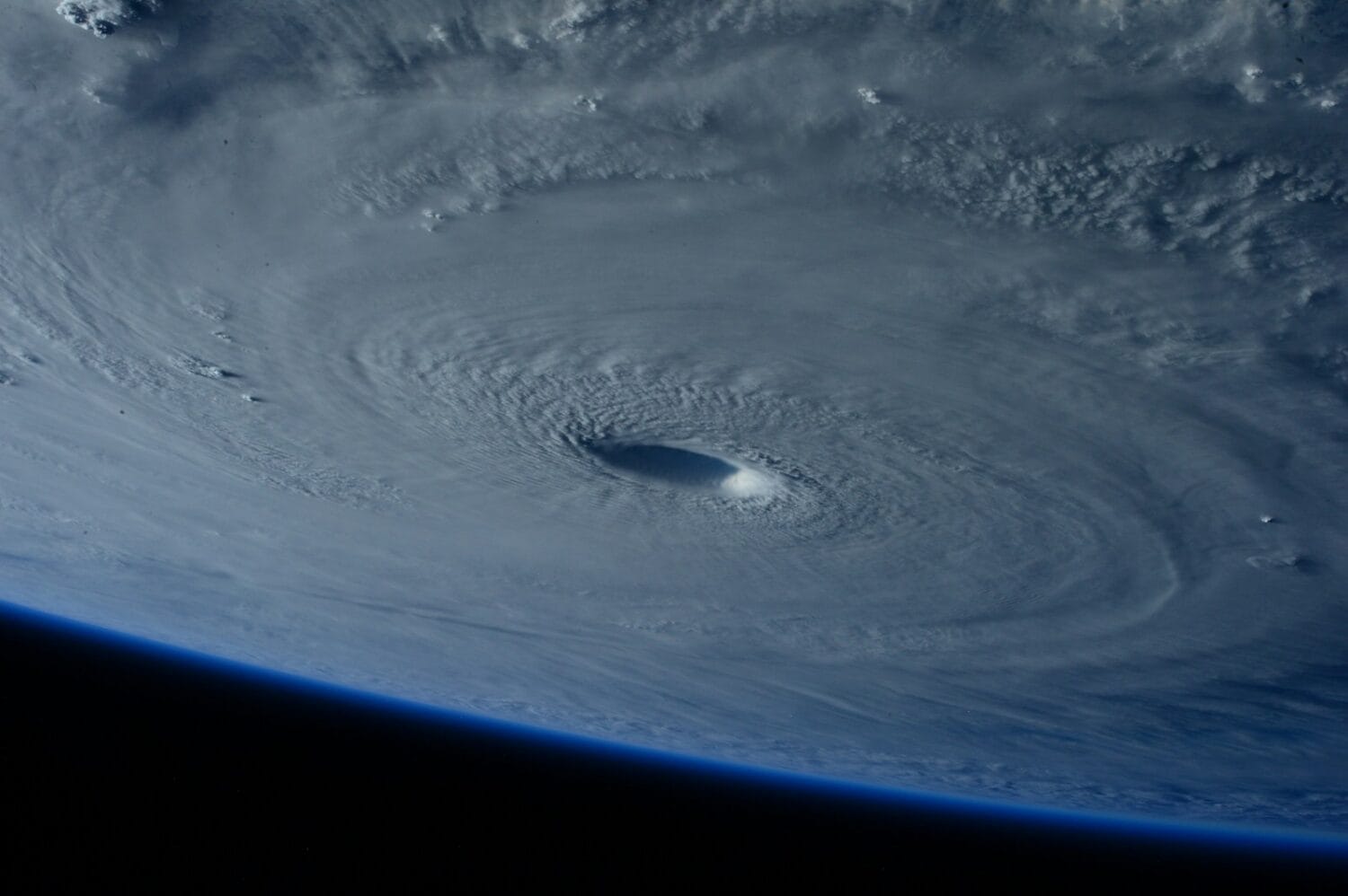
The recordings from inside the eye of the hurricane, recorded by the American Hurricane Hunters and the National Air Operations Center of the NOAA, show the stadium effect, the characteristic structure of the cloud wall around the eye of the storm. These materials allow a better understanding of the magnitude and dynamics of this powerful element.
,,Photos taken from inside a fighter plane flying over the eye of Hurricane Erin show how the crew experiences a shock as it penetrates the inner walls of a powerful Category 5′′ hurricane.
Experts expect the hurricane to gradually weaken when moving to cooler waters and further away from the Caribbean region, and its intensity will change over the following days.